


Voting District 1632102000002, Wayne County, Michigan
About
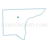
Outline

Summary
| Unique Area Identifier | 600615 |
| Name | Voting District 1632102000002 |
| County | Wayne County |
| State | Michigan |
| Area (square miles) | 0.75 |
| Land Area (square miles) | 0.75 |
| Water Area (square miles) | 0.00 |
| % of Land Area | 100.00 |
| % of Water Area | 0.00 |
| Latitude of the Internal Point | 42.33475890 |
| Longtitude of the Internal Point | -83.26349700 |
Maps


Graphs
Select a template below for downloading or customizing gragh for Voting District 1632102000002, Wayne County, Michigan


Neighbors
Neighoring Voting District (by Name) Neighboring Voting District on the Map
- Voting District 1632100000033, Wayne County, MI
- Voting District 1632100000034, Wayne County, MI
- Voting District 1632102000003, Wayne County, MI
- Voting District 1632102000004, Wayne County, MI
- Voting District 1632102000009, Wayne County, MI
- Voting District 1632102000031, Wayne County, MI
- Voting District 1632102000037, Wayne County, MI
- Voting District 1632200018018, Wayne County, MI
Top 10 Neighboring County Subdivision (by Population) Neighboring County Subdivision on the Map
- Detroit city, Wayne County, MI (713,777)
- Dearborn city, Wayne County, MI (98,153)
- Dearborn Heights city, Wayne County, MI (57,774)
Top 10 Neighboring Place (by Population) Neighboring Place on the Map
Top 10 Neighboring Unified School District (by Population) Neighboring Unified School District on the Map
- Detroit City School District, MI (713,865)
- Dearborn City School District, MI (106,337)
- Crestwood School District, MI (28,309)
Top 10 Neighboring State Legislative District Lower Chamber (by Population) Neighboring State Legislative District Lower Chamber on the Map
- State House District 17, MI (90,344)
- State House District 15, MI (89,065)
- State House District 10, MI (68,956)
Top 10 Neighboring State Legislative District Upper Chamber (by Population) Neighboring State Legislative District Upper Chamber on the Map
Top 10 Neighboring 111th Congressional District (by Population) Neighboring 111th Congressional District on the Map
- Congressional District 11, MI (695,888)
- Congressional District 15, MI (682,205)
- Congressional District 14, MI (550,465)
Top 10 Neighboring Census Tract (by Population) Neighboring Census Tract on the Map
- Census Tract 5721, Wayne County, MI (6,177)
- Census Tract 5746, Wayne County, MI (4,913)
- Census Tract 5799, Wayne County, MI (4,615)
- Census Tract 5715, Wayne County, MI (4,585)
- Census Tract 5462, Wayne County, MI (2,863)
- Census Tract 5717, Wayne County, MI (2,401)
- Census Tract 5720, Wayne County, MI (1,899)
- Census Tract 5716, Wayne County, MI (1,672)